Fabrice Blocteur may not be as well known as Marco Polo, Vasco da Gama, Ferdinand Magellan or Sir Francis Drake. But like explorers of old, this French-Canadian resident of a rural Kyoto village is on a quest to rewrite the maps through new discoveries.
In Blocteur's case, it is not vast new lands he is in search of, but confluence points -- precise points that are on or near land where lines of longitude and latitude cross and the coordinates are whole numbers.
"Measurements in longitude and latitude are in degrees and minutes. A confluence point is the intersection of longitude and latitude where minutes go to zero," the 51-year-old Montrealer explained.
An avid hiker with a strong interest in geography and topography, Blocteur is one of a handful of people in Japan and around the world who travel, at their own expense, to confluence points, then photograph them and report their findings to the Degree Confluence Project (DCP). This is a loose network of amateur adventurers who identify and record confluence points on or within sight of land and then incorporate their visual evidence and also their traveler's tales on the DCP Web site.
As to why they do it, well, as Blocteur said, "Part of the reason is the same as Sir Edmund Hillary gave as his reason for climbing Mount Everest in 1953: 'Because it's there.' "
However, "there is more to it than that," he explained. "Primarily, when I head off to a confluence point, the means are more important than the end. It doesn't really matter if my visit is a success or not -- although I won't deny that I'm particularly happy when I do succeed -- but I like all the preparation it takes, the history I learn and the unknown things I will necessarily encounter. Success or not, I'm always very satisfied with what I've seen and learned."
And there's certainly a lot to learn, because as Blocteur explained, there are 64,442 confluence points in the world. Most are in oceans, and so finding them is not a goal of the project. There are, however, 16,173 points that do fit the criteria for discovery, and to this day around 12,000 remain to be visited and recorded.
"Once you get to a spot, you have to prove, preferably with a photo of a small global-positioning satellite reading at zero minutes, that you actually visited it. The rules of the project are that you have to be within 100 meters of the actual point before you get credit for visiting it," Blocteur said.
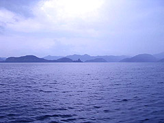
As of this summer, Blocteur has visted 21 confluence points in four countries, including 16 in Japan, where his explorer's spirit has taken him from the Goto Islands off Nagasaki Prefecture (confluence point 33N, 129E) to the deep,dark forests of Gifu Prefecture (confluence point 36N, 137E).
To city slickers, finding a confluence point might sound like a pretty easy, and -- ho-hum -- pointless way to spend your free time . . . and not inconsiderable amounts of money. After all, any weekend warrior can walk into their local electronics store, plunk down anything between 15,000 yen and 150,000 yen for a global positioning system that will lead them to a confluence point, right?
In fact that's pretty well how Blocteur himself got started in February 2003, after he bought a GPS and decided to try out his "new toy" by following its readings to reach 135E,35N in Nishiwaki City, Hyogo Prefecture, which is the nearest confluence point to his home.
"Unfortunately," he recalled with a laugh, "I just wanted to try out the GPS and I didn't even look at a map. So a friend and I hacked our way through the forest, thinking 'this is pretty difficult.' Then when we got there -- it's called the "navel of Japan," because it is the center point of the archipelago -- we discovered that our efforts had been unnecessary because there were roads to it and even monuments there."
It seems, though, that such ease of access (if you avail yourself of it) is the exception in this country.
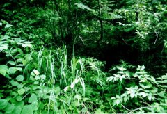
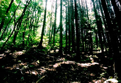
"Generally, it's not as simple as it may seem to get to find these exact locations," Blocteur said. "Many confluence points in Japan are located in very remote and mountainous areas, in thick forests, or in ravines or gullies that are difficult to reach, even for experienced hikers."
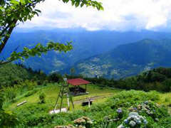
It was to log one of these that, in June this year, Blocteur and a friend made a journey from their home near the Amanohashidate (Bridge to Heaven) in northern Kyoto Prefecture, where he teaches English at a private school, to Shikoku to pinpoint the confluence point 34N, 134E. It was the second time hehad made the trip, following a breakdown of his GPS unit the previous July that forced him to abandon the search.
Although another person had claimed to have found the point shortly after Blocteur had to give up last year, he decided to return in June.
"The whole area surrounding the confluence point is gorgeous. It's only a few kilometers from the Iya Valley, considered by Japanese to be one of the 'three hidden regions' of the country and romanticized in Alex Kerr's fascinating book, 'Lost Japan.' But this region is difficult to navigate," Blocteur wrote in his Web log of the visit.
He wasn't exaggerating. In the sweltering summer heat, it took three tries over two days, climbing up steep rocks, nearly falling off a bridge, and hacking his way through thick brush and undergrowth that left him with cuts and scratches, before Blocteur finally got within 30 meters of the point.
His quest successful, he then took a few pictures, climbed down to the nearest hiking trail, and headed off for a hot bath at a local minshuku.
As it turned out, Blocteur may have actually been the first person to have ever come back with evidence of reaching that confluence point. That's not because those who visited the area the year before were making up their story, but because they had used a different data standard.
"Confluence points for the confluence project have to be found using an international standard of data that is programmed into most GPS devices," Blocteur explained. "But in Japan and many other countries, the international data standard can differ slightly from maps and charts drawn up by the country itself.
"This means that a confluence point on a Japanese map might actually be a couple of hundred meters away from what a GPS programmed to international standards would give you.
"Those who visited the confluence point last year appear to have found the point using Japanese, not international, data," he said.
Such discrepencies are not unique to Japan, he added. Many countries that drew up their own maps have similiar differences. It was just this difference between Japanese and international topographical data that got Blocteur interested in confluence points. Several years ago, he purchased a GPS for his own use, only to discover that when it came time to be programmed, he had the choice of using several different data, including "Tokyo datum" and the international system "WGS84."
WGS84, Blocteur explained, stands for "World Geodetic System 1984," an international standard whose coordinates differ from Japanese maps, often by hundreds of meters.
A difference of a couple of football fields between the coordinates of a GPS programmed to Japanese standards and one with the WGS84 system may not sound like anything important or worthy of making a "Heart of Darkness"-like journey to locate, and it might be tempting to dismiss Blocteur and his fellow campers as overzealous Boy Scouts.
There is, however, a very serious aspect to what they are doing. "Let's say you're hiking alone in the woods and you have an accident that requires immediate medical attention. You call somebody and give them your GPS satellite coordinates which are based on international data. But if your rescuers are using Japanese datum on their GPS, and you were using the WGS84 datum on yours, they could end up several hundred meters away from your location.
"It's easy to imagine them stumbling around in a dark forest trying to find you when you require immediate medical attention and every minute counts."
When attempting to find a confluence point, Blocteur plots a careful course over the most detailed maps he can get his hands on, then feeds the data into his computer, which uses special software to pinpoint the confluence point and provide a printout of the area with X marking the spot.
After that, getting there can involve planes, trains, a motorbike, shoe leather -- and luck.
Thus, it's the hope of Blocteur that, eventually, maps will be redrawn to put Japanese and international confluence points as close to each other as possible, say, within a few meters.
However, he is most definitely not doing it for the money, the fame or the glory. Nor, he says, are there any plans to publish his own set of maps with Japan's confluence points clearly marked.
"It's the spirit of adventure that's driving me. I love hiking in Japan, and this is a great way to get to places I'd otherwise probably never get to, as well as provide what will hopefully be useful information to those interested in orienteering," he says.
Who says the spirit and romance of The Age of Discovery is a thing of the past?


, tells her story to lawmakers from the Constitutional Democratic Party of Japan on April 9.")

 battles Atamifuji during a regional tour event in Hyogo Prefecture in 2023.")


With your current subscription plan you can comment on stories. However, before writing your first comment, please create a display name in the Profile section of your subscriber account page.